1909 Atlas ANDREW COUNTY MISSOURI plat maps old GENEALOGY history DVD P133

$3.16 (-40%)
Coins of India Reference Library
This DVD is part of our Historic Atlas
Collection.
We have dozens of Atlas maps on DVD ranging from the 1500s to the
1900s covering many areas and topics.
Please Check our Ebay Store for what’s available.
HIGH RESOLUTION
MAP COLLECTION
ON DVD!!
(please see full table of contents and sample
illustrations below)
Title of
this
Atlas:
Andrew County Atlas,
Missouri
mo102
Title Page
mo103
Table of Contents
mo104
Map of Andrew County, Missouri
mo105
Savannah County Seat of Andrew County
mo106
Township 58 North Range 33 & 34 West of 5th P.M.
mo107
Township 61 North Range 33 & 34 West of 5th P.M.
mo108
Township 60 North Ranges 33 & 34 West of 5th P.M.
mo109
Township 59 North Range 33 & 34 West of 5th P.M.
mo1010
Township 61 North Range 35 West of 5th P.M.
mo1011
Township 60 North Range 35 West of 5th P.M.
mo1012
Township 59 North Range 35 West of 5th P.M.
mo1013
Township 58 North Range 35 & 36 West of 5th P.M.
mo1014
Township 59 North Range 36 & 37 West of 5th P.M.
mo1015
Township 60 North Range 36 & 37 West of 5th P.M.
mo1016
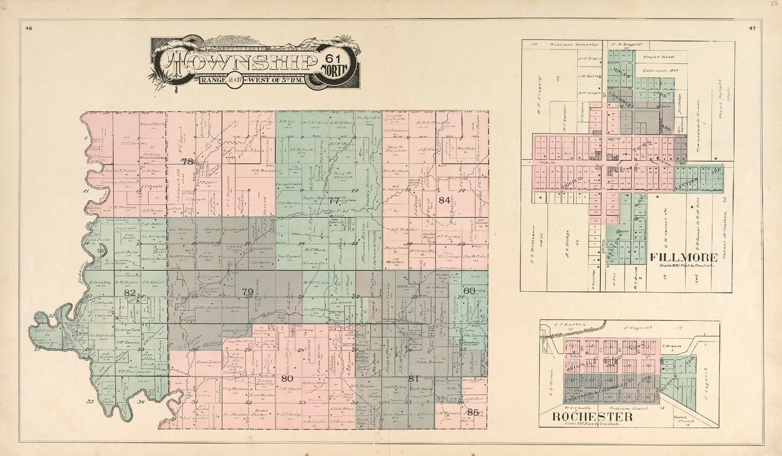
Township 61 North Range 36 & 37 West of 5th P.M.
mo1017
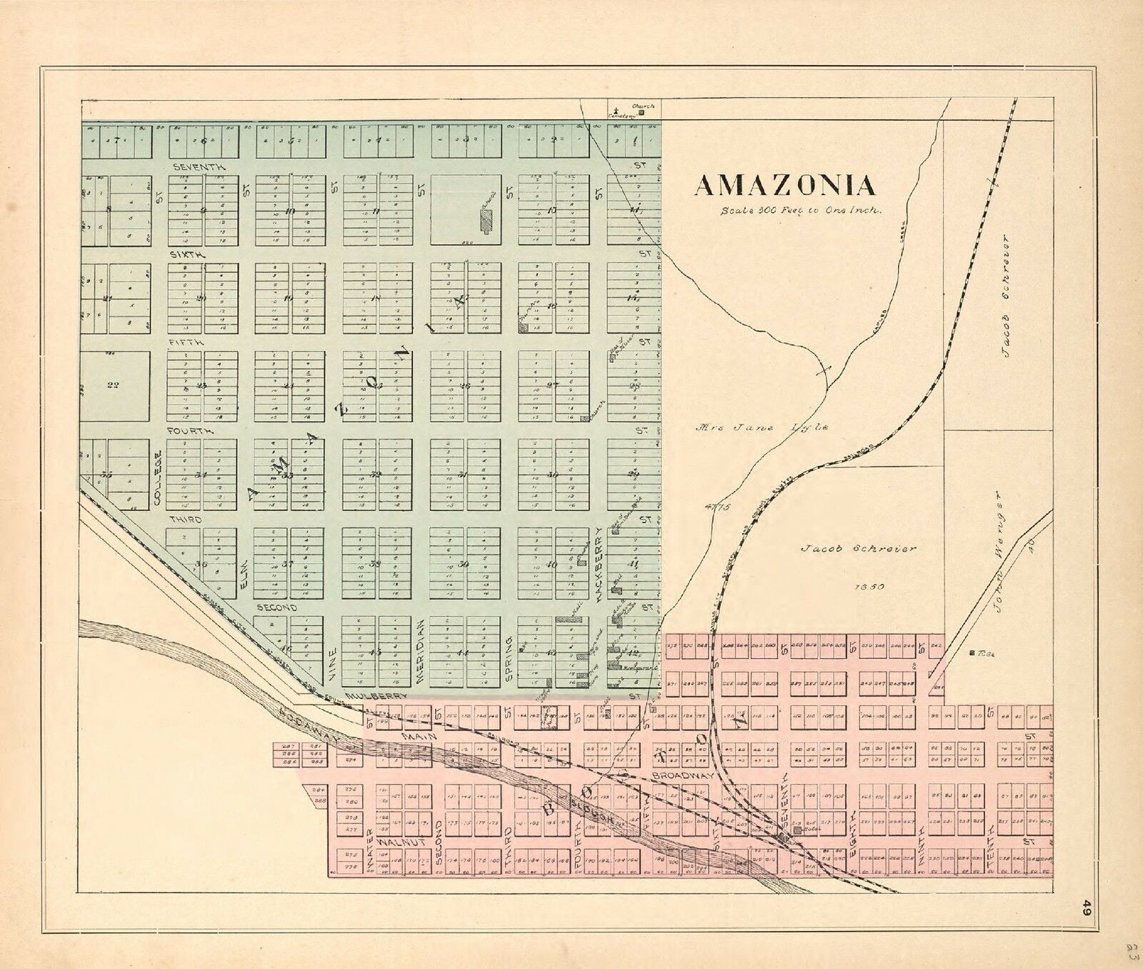
Amazonia
mo1018
Bolckow
mo1019
Helena; Whitesville
mo1020
Missouri
mo1021
United States
mo1022
Patron’s Directory of Andrew County, Missouri
mo1023
Patron’s Directory
mo1024
Patron’s Directory; An Historical Sketch
mo1025
Survey of Public Lands
mo1026
Survey of Public Lands
Features of this DVD
This auction is for a DVD -ROM of the maps
listed in electronic form,
NOT
the maps
themselves.
These maps are VERY high resolution and
can be printed at FULL SCALE or LARGER for framing and display. The results
are very high quality and convincing The files are in PDF format for easy
of viewing and printing.
Maps can be viewed and many scales and zoom
features are available as with any PDF file.
Ad and DVD copyright 2016
John Beck
All Rights Reserved