123 maps ARKANSAS STATE PANORAMIC history atlas old GENEALOGY DVD


$3.16 (-40%)
Your browser does not support JavaScript.
To view this page, enable JavaScript if it is disabled or upgrade your browser.
Rare Map Collection
This DVD is part of our Historic Map and
Atlas Collection.
We have dozens of Atlas maps on DVD and CD ranging from the 1500s
to the 1900s covering many areas and topics.
Please Check our Ebay Store for what’s available.
FOR MANY MORE EDUCATIONAL CD
TITLES
ON THIS AND MANY OTHER
SUBJECTS
PLEASE VISIT OUR EBAY STORE
VERY LARGE HIGH RESOLUTION
MAP COLLECTION
ON DVD!!
(please see full table of contents and sample
illustrations below)
This DVD Contains
123 Maps
of
Arkansas
These are scans of the
ORIGINAL
maps
by various Cartographers.
on DVD
System requirements
PC or Mac compatible.
Files are simple PDF files with a basic HTML
interface (just like viewing a webpage)
Works with ALL versions of Windows.
Arkansas Map Collection
0041014
Arkansas, Indian Territory. Shows townships, distances along railroads,
etc. Prime meridians: Greenwich and Washington.
Asher & Adams
1874
0089035
Arkansas
Bradford, Thomas G.
1838
0149042
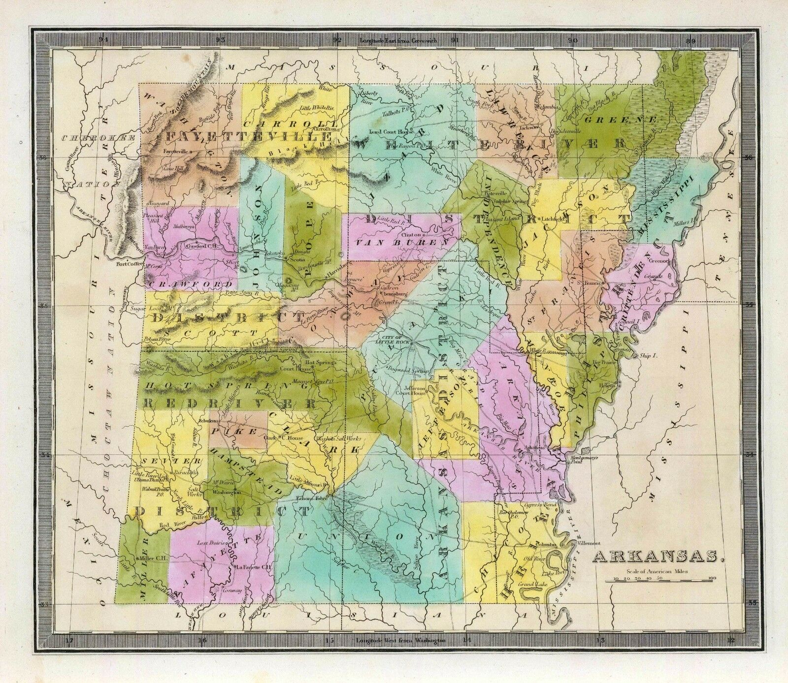
Arkansas.
Colton, G.W.
1856
0537026
New Map Of Arkansas.
Mitchell, Samuel Augustus
1846
0977022
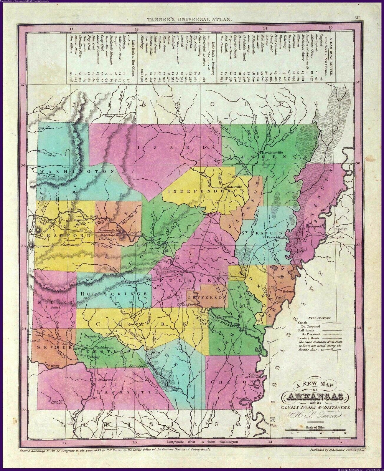
New Map Of Arkansas
Tanner, Henry S.
1836
1070010
Arkansas. Map in outline color. Coal regions are shown in gray.
U.S. General Land Office
1866
1780053
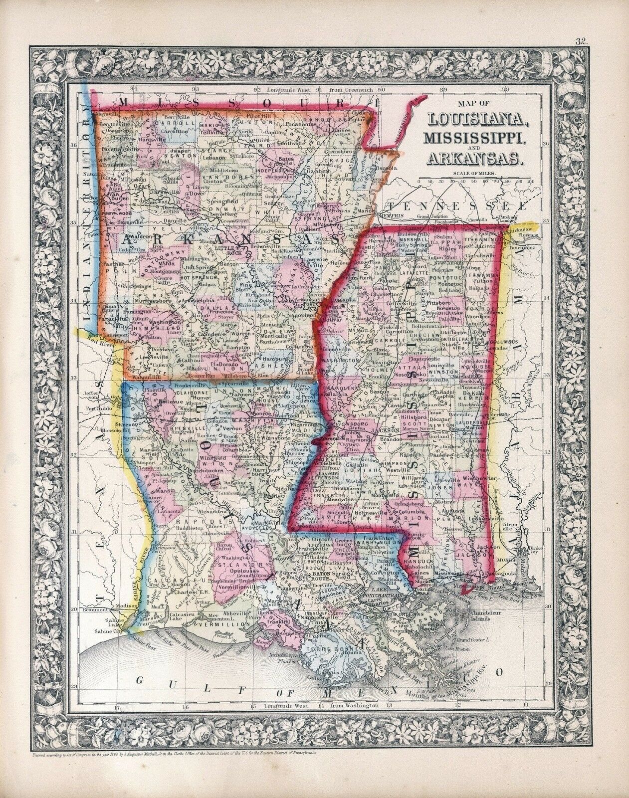
Parts Arkansas, Louisiana.
Confederate States of America. Army
1895
1780157
Arkansas Gen. map XIX.
Julius Bien & Co.; United States. War Department
1895
2301029
Arkansas
Morse, Sidney Edwards ; Breese, Samuel
1845
2743006
Arkansas, Louisiana und Mississippi.
Lange, Henry
1854
3565130
New business atlas map of Arkansas.
Rand McNally and Company
1897
4453037
Arkansas.
Goodrich, S.G. ; Bradford, Thomas G.
1841
4584070
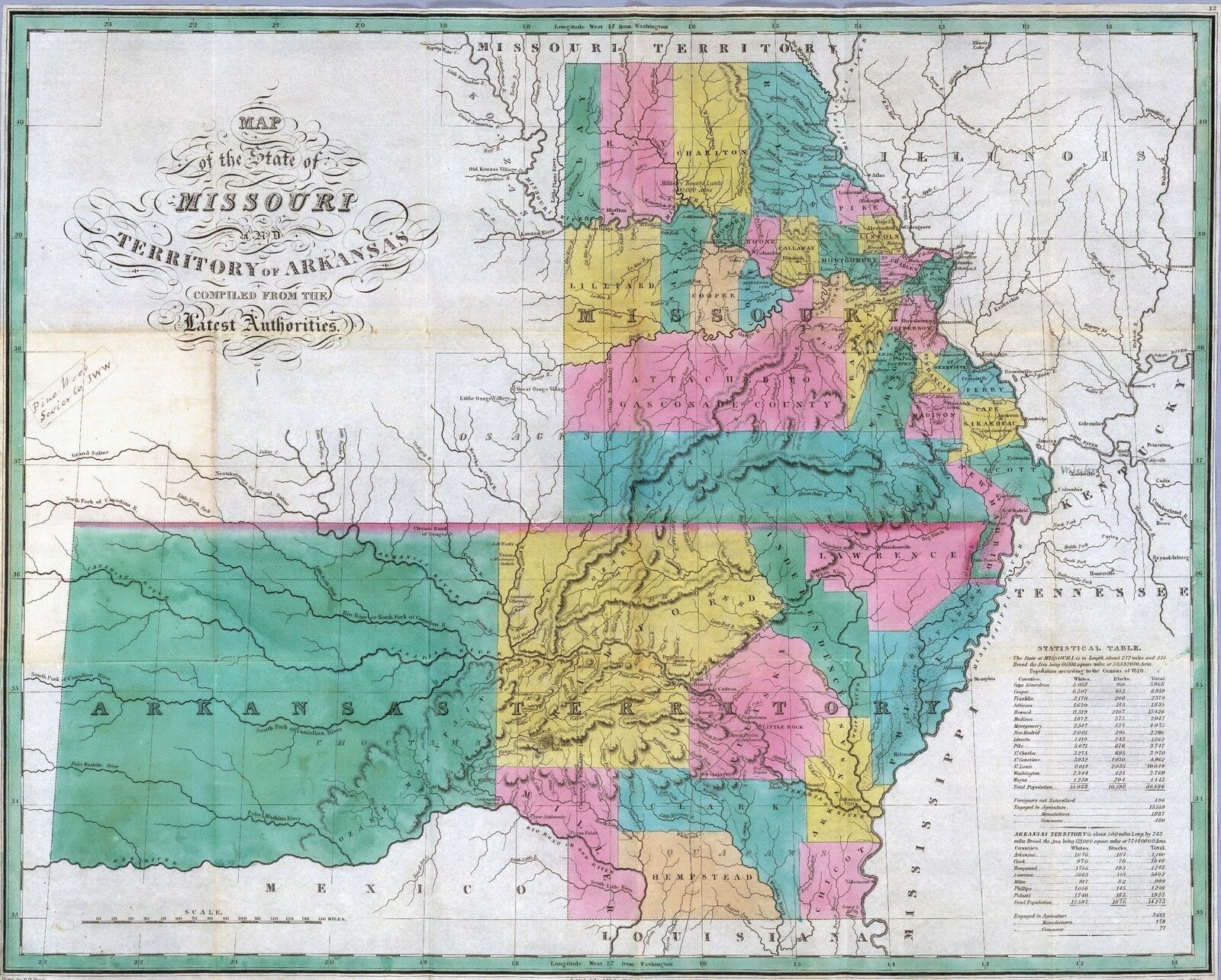
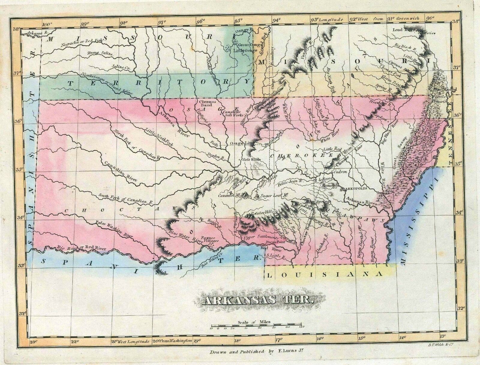
Arkansas Territory
Lucas, Fielding Jr.
1823
4628050
Arkansas.
Burr, David H.
1835
4807162
Arkansas.
Meyer, Joseph
1845
4850050
Arkansas.
Greenleaf, Jeremiah
1840
4966014
Map of the states of Mississippi, Louisiana and the Arkansas Territory.
Hinton, John Howard; Hinton, Isaac Taylor; Simpkin & Marshall.
1832
5370021
Arkansas.
Cram Atlas Company
1875
5457000
State of Arkansas.
U.S. General Land Office
1878
ct000818
Shall, D. F.
Colton’s railroad & township map of Arkansas complied from the U.S.
Surveys and other authentic sources.
1854
ct001271
Geological Survey of Arkansas.
Map of Washington County / John C. Branner, state geologist ; Frederic W.
Simonds, assistant geologist.
1888
cw0115000
Fendall, C.
Approaches to Fort Hindman, Arkansas Post, on the Arkansas River : captured
by the U.S. Mississippi Squadron, under command of Act’g. Rear Admiral
David D. Porter, U.S.N., January 11th, 1863 / surveyed by C. Fendall, sub.
assistant, U.S. Coast Survey, acting under orders of Rear Admiral D.D. Porter
; U.S. Coast Survey, A.D. Bache, supdt.; autographic transfer, J.W. Maedel.
1863
cw0115200
United States. Navy.
View of Fort Hindman, Arkansas Post. [January 11, 1863]
1863
cw0116000
United States. Army. Corps of Engineers.
Map of the battlefield of Pea Ridge, Arkansas, showing the positions of the
United States and Confederate forces on the 8th of March 1862 From a map
forwarded to the Engineer Department Sept. 11th 1865 by Brevet Brig. Gen.
C. B. Comstock A.D.C.
1876
cw0230000
Holtz, Helmuth.
Map of Louisiana & Arkansas. Prepared under direction of 1st Lieut. Wm.
Hoelcke, 39 U.S. Infty, acting Chief Engineer at hd. qts. Dept. of La., by
Helmuth Holtz.
1864?
la002009
Knobel, G.
Hope, Hempstead Co., Ark. / G. Knobel, Cil. Engr.
Texarkana, Ark. : Wilson Engineering & Supply Co
1916
mf000044
United States. Topographical Bureau.
Map showing the lands assigned to emigrant Indians west of Arkansas and Missouri.
1836
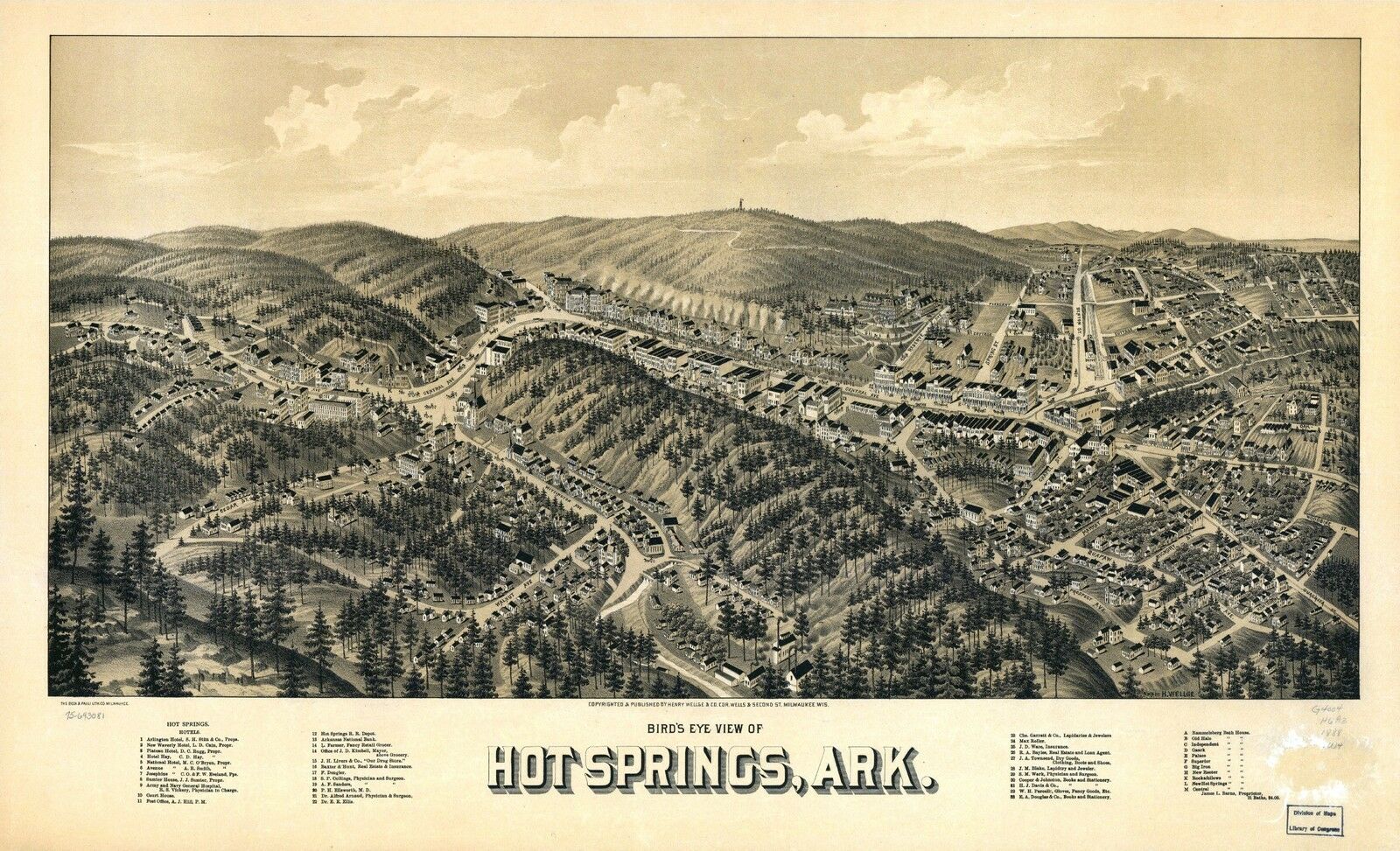
pm000120
Wellge, Henry
Bird’s eye view of Hot Springs, Ark. Drawn by H. Wellge, Beck &
Pauli Lith. Co.
1888?
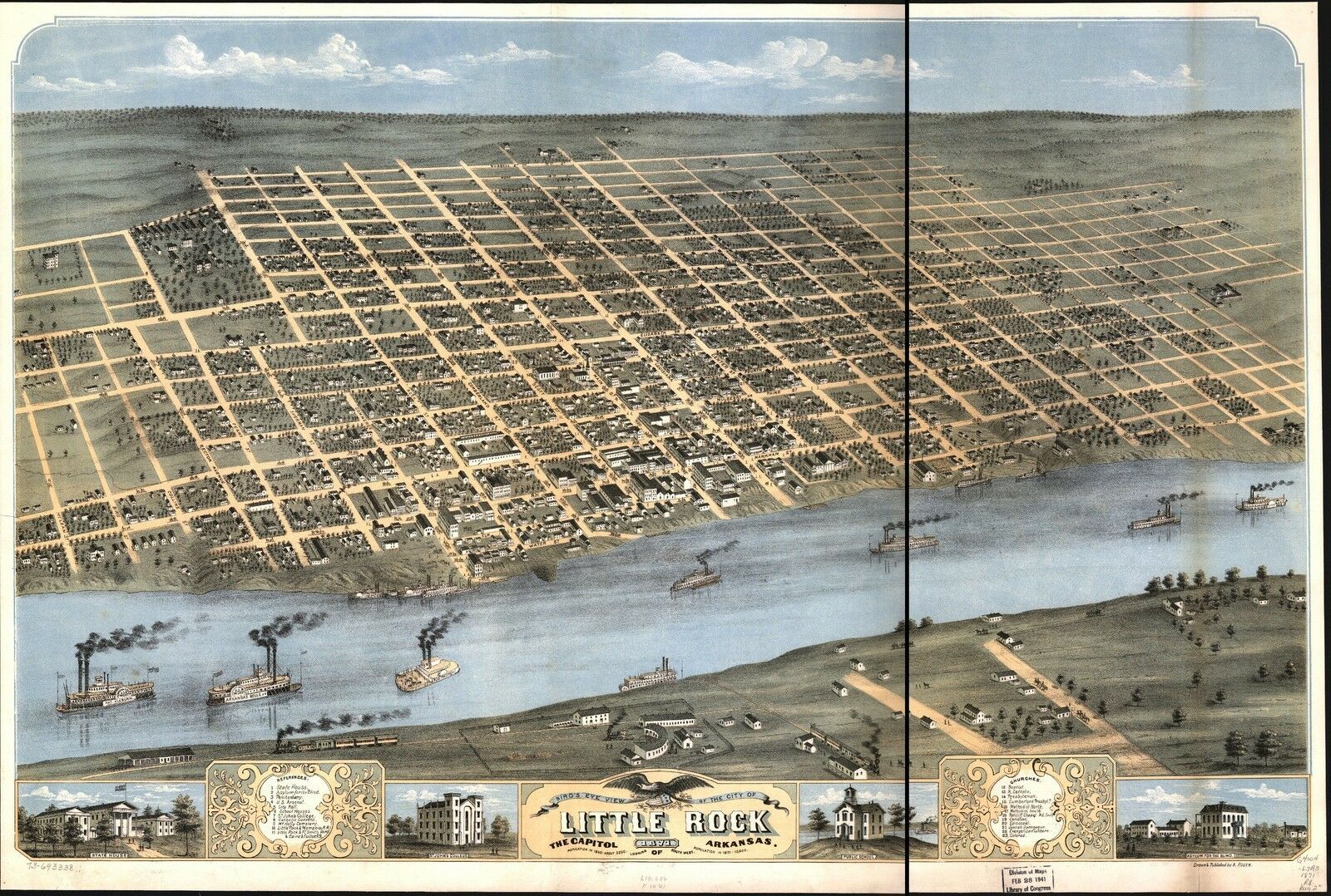
pm000130
Ruger, A.
Bird’s eye view of the city of Little Rock, the capitol of Arkansas
1871. Drawn & published by A. Ruger.
1871
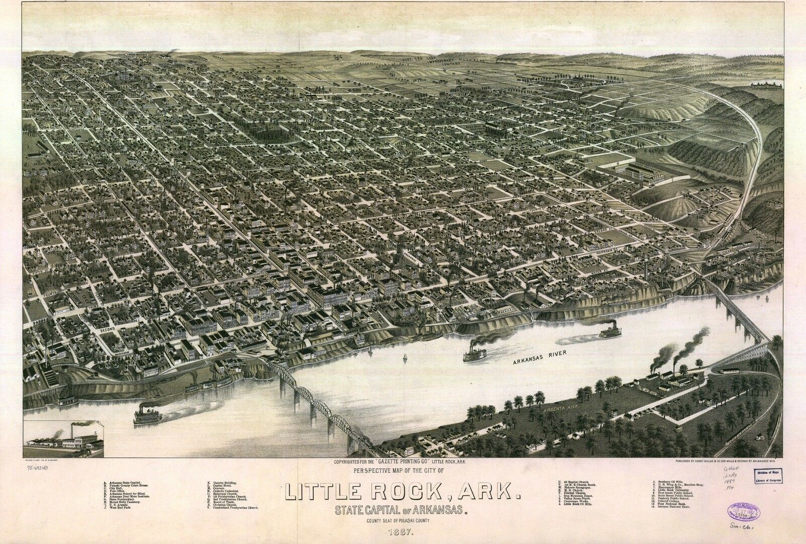
pm000140
Henry Wellge & Co.
Perspective map of the city of Little Rock, Ark., State capital of Arkansas,
county seat of Pulaski County. 1887. Beck & Pauli Lith. Co.
1887
pm000150
Henry Wellge & Co.
Perspective map of, Texarkana, Texas and Arkansas. Beck & Pauli Lith.
1888?
pm000160
Wellge, H. (Henry)
Perspective map of Van Buren, Ark. county seat of Crawford County 1888. H.
Wellge, sk. Beck & Pauli Lith. Co.
1888
pm010910
Hot Springs, Arkansas
Woodward & Tiernam Printing Co.
c1890.
rr001340
Burr, David H.
Map of Mississippi, Louisiana & Arkansas exhibiting the post offices,
post roads, canals, rail roads, &c. / by David H. Burr (late topographer
to the Post Office), Geographer to the House of Representatives of the U.S.
1839
rr001470
Sidell, William Henry, 1810-1873.
Map of the route surveyed from the Mississippi at Lake Providence in Louisiana
to the great bend of Red river at Fulton in Arkansas / under the orders of
Col. J. J. Abert, Chief of the Corps of Topographical Engineers by W. H.
Sidell, Civil Engineer, 1850.
1850
rr001830
Shall, D. F.
Colton’s railroad & township map of Arkansas complied from the U.S.
Surveys and other authentic sources.
1854
rr001840
Cram, George Franklin, 1841-1928.
Cram’s township and rail road map of Arkansas.
1895
rr001850
Rand McNally and Company.
The Rand McNally indexed county and township pocket map and shippers guide
of Arkansas showing all railroad, cities, towns, villages, post offices,
lakes, rivers, etc.
1898
rr003200
G.W. & C.B. Colton & Co.
Maps showing Arkansas Central, the Helena & Corinth, and the Pine Bluff
& Southwestern Railroads together forming the Texas & Northeastern
Railway.
1872
rr003580
Wilamowicz, I.
Map of the Cairo & Fulton Railroad exhibiting the principal tributary
lines as projected and its connections with other railroads west of the
Mississippi River, which unite with the Missouri Pacific Railroad, and south
projected Pacific Railroad via Elpaso [sic] to the Pacific Ocean, showing
also the connection by rail road of the cities of New Orleans & St. Louis.
Little Rock, Ark. Sep. 1853.
1853
rr004430
G.W. & C.B. Colton & Co.
Maps showing the connections of the Little Rock and Fort Smith Railroad and
its land grant.
1873
rr004440
United States. General Land Office.
Map of Franklin County, Arkansas; showing the land grant of the Little Rock
& Fort Smith Railway.
1893
rr004570
Woodward, Tiernan, and Hale.
Map of the lands of the Memphis & Little Rock Railroad Company (as
reorganized)
1878
0041014
Arkansas, Indian Territory. Shows townships, distances along railroads,
etc. Prime meridians: Greenwich and Washington.
Asher & Adams
1874
0089035
Arkansas
Bradford, Thomas G.
1838
0149042
Arkansas.
Colton, G.W.
1856
0537026
New Map Of Arkansas.
Mitchell, Samuel Augustus
1846
0977022
New Map Of Arkansas
Tanner, Henry S.
1836
1070010
Arkansas. Map in outline color. Coal regions are shown in gray.
U.S. General Land Office
1866
1780053
Parts Arkansas, Louisiana.
Confederate States of America. Army
1895
1780157
Arkansas Gen. map XIX.
Julius Bien & Co.; United States. War Department
1895
2301029
Arkansas
Morse, Sidney Edwards ; Breese, Samuel
1845
2743006
Arkansas, Louisiana und Mississippi.
Lange, Henry
1854
3565130
New business atlas map of Arkansas.
Rand McNally and Company
1897
4453037
Arkansas.
Goodrich, S.G. ; Bradford, Thomas G.
1841
4584070
Arkansas Territory
Lucas, Fielding Jr.
1823
4628050
Arkansas.
Burr, David H.
1835
4807162
Arkansas.
Meyer, Joseph
1845
4850050
Arkansas.
Greenleaf, Jeremiah
1840
4966014
Map of the states of Mississippi, Louisiana and the Arkansas Territory.
Hinton, John Howard; Hinton, Isaac Taylor; Simpkin & Marshall.
1832
5370021
Arkansas.
Cram Atlas Company
1875
5457000
State of Arkansas.
U.S. General Land Office
1878
ct000818
Shall, D. F.
Colton’s railroad & township map of Arkansas complied from the U.S.
Surveys and other authentic sources.
1854
ct001271
Geological Survey of Arkansas.
Map of Washington County / John C. Branner, state geologist ; Frederic W.
Simonds, assistant geologist.
1888
cw0115000
Fendall, C.
Approaches to Fort Hindman, Arkansas Post, on the Arkansas River : captured
by the U.S. Mississippi Squadron, under command of Act’g. Rear Admiral
David D. Porter, U.S.N., January 11th, 1863 / surveyed by C. Fendall, sub.
assistant, U.S. Coast Survey, acting under orders of Rear Admiral D.D. Porter
; U.S. Coast Survey, A.D. Bache, supdt.; autographic transfer, J.W. Maedel.
1863
cw0115200
United States. Navy.
View of Fort Hindman, Arkansas Post. [January 11, 1863]
1863
cw0116000
United States. Army. Corps of Engineers.
Map of the battlefield of Pea Ridge, Arkansas, showing the positions of the
United States and Confederate forces on the 8th of March 1862 From a map
forwarded to the Engineer Department Sept. 11th 1865 by Brevet Brig. Gen.
C. B. Comstock A.D.C.
1876
cw0230000
Holtz, Helmuth.
Map of Louisiana & Arkansas. Prepared under direction of 1st Lieut. Wm.
Hoelcke, 39 U.S. Infty, acting Chief Engineer at hd. qts. Dept. of La., by
Helmuth Holtz.
1864?
0027012.jpg
0041014.jpg
0041041.jpg
0073013.jpg
0089035.jpg
0102035.jpg
0104009.jpg
0122030.jpg
0149042.jpg
0151048.jpg
0152047.jpg
0278012.jpg
0280012.jpg
0315008.jpg
0341002.jpg
0341004.jpg
0352032.jpg
0358037.jpg
0425011.jpg
0535030.jpg
0537026.jpg
0545029.jpg
0565019.jpg
0572028.jpg
0579029.jpg
0586027.jpg
0592029.jpg
0594028.jpg
0977022.jpg
1070010.jpg
1550043.jpg
1690090.jpg
1780053.jpg
1780157.jpg
1954094.jpg
2054036.jpg
2094040.jpg
2134077.jpg
2301029.jpg
2307020.jpg
2372002.jpg
2392000.jpg
2483025.jpg
2544007.jpg
2710034.jpg
2738086.jpg
2738112.jpg
2743006.jpg
2809048.jpg
2844060.jpg
2915005.jpg
2980001.jpg
3050002.jpg
3327001.jpg
3471009.jpg
3565130.jpg
3565145.jpg
3803030.jpg
3825012.jpg
3884012.jpg
3888032.jpg
4217001.jpg
4328028.jpg
4453037.jpg
4506002.jpg
4520028.jpg
4520050.jpg
4557026.jpg
4574027.jpg
4578026.jpg
4584070.jpg
4587047.jpg
4628050.jpg
4646000.jpg
4727040.jpg
4804002.jpg
4807162.jpg
4825046.jpg
4835034.jpg
4850050.jpg
4866057.jpg
4889003.jpg
4966014.jpg
4977030.jpg
5028118.jpg
5041029.jpg
5060000.jpg
5198024.jpg
5363026.jpg
5370021.jpg
5370027.jpg
5457000.jpg
5479076.jpg
5745053.jpg
5755029.jpg
5784028.jpg
6727028.jpg
6921125.jpg
Features of this DVD
This auction is for a DVD of the maps listed
in electronic form,
NOT
the maps
themselves.
These maps are VERY high resolution and
can be printed at FULL SCALE or LARGER for framing and display. The results
are very high quality and convincing.
Ad and disk copyright 2019
All Rights Reserved